Precision, speed, and efficiency — our Drone & LiDAR surveying solutions bring cutting-edge technology to the field of mapping and data collection. By combining high-resolution aerial imagery with laser-based scanning, we deliver highly accurate 2D and 3D models that support smarter decision-making across residential, commercial, and infrastructure projects.

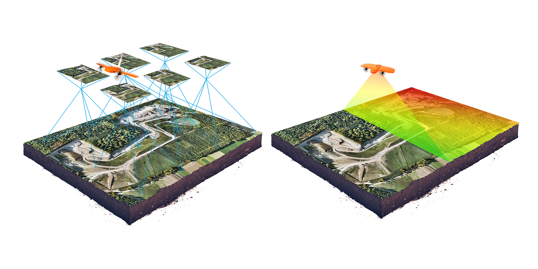
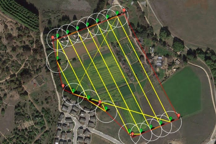
Our aerial drone surveys deliver high-resolution imagery and accurate mapping at a fraction of the time and cost of traditional surveying methods. Equipped with advanced UAV technology, we capture detailed aerial data that provides a complete overview of your site. This allows stakeholders to monitor construction progress, land development, environmental changes, and site conditions with clarity and efficiency. By reducing the need for ground teams in difficult or hazardous terrain, drone surveys not only save time but also improve safety. The captured data can be seamlessly integrated into CAD, GIS, and BIM platforms, enabling faster analysis and better decision-making across all stages of a project.
LiDAR mapping is one of the most powerful tools for high-precision 3D data collection. Using laser pulses emitted from drones or aerial platforms, LiDAR creates dense point clouds that accurately represent ground surfaces, vegetation, and built structures — even beneath forest canopies or in hard-to-access locations. This technology is invaluable for topographic studies, flood risk analysis, infrastructure planning, forestry management, and corridor mapping. Unlike traditional photogrammetry, LiDAR captures minute details and provides elevation data with remarkable accuracy, making it essential for projects where precision cannot be compromised. The data can be transformed into detailed 3D models, contour maps, and digital elevation models (DEMs) that guide engineering and planning decisions with confidence.
we create smart, sustainable, and lasting solutions. Our reputation is built on experience, expertise, and an unwavering commitment to client satisfaction. Here’s why clients across Northeast India trust us:
With decades of field experience, we understand regional challenges and deliver projects that stand the test of time — both structurally and functionally
Our team includes certified drone pilots, engineers, architects, and project managers who bring deep knowledge and a results-driven approach to every assignment.
We utilize cutting-edge tools like LiDAR drones, GIS, and advanced modeling software to ensure data accuracy, efficient planning, and reliable project execution.
From consultation to post-project assistance, our team is always available to guide, inform, and support — ensuring a smooth, stress-free experience for our clients.
Have a project in mind or need expert consultation for surveying, design, or infrastructure development? We’re here to help. Get in touch with our team to discuss your requirements and explore how TN Consultant can bring your vision to life.
Have a project in mind or need expert advice? Reach out — we’re here to help you every step of the way.
Have a project in mind or need expert advice? Reach out — we’re here to help you every step of the way.