Accurate data is the foundation of great design. Our Survey & Mapping Solutions provide the precision and clarity needed to plan, design, and execute projects with confidence. Using advanced technology and field expertise, we deliver reliable spatial insights that guide smarter decisions.

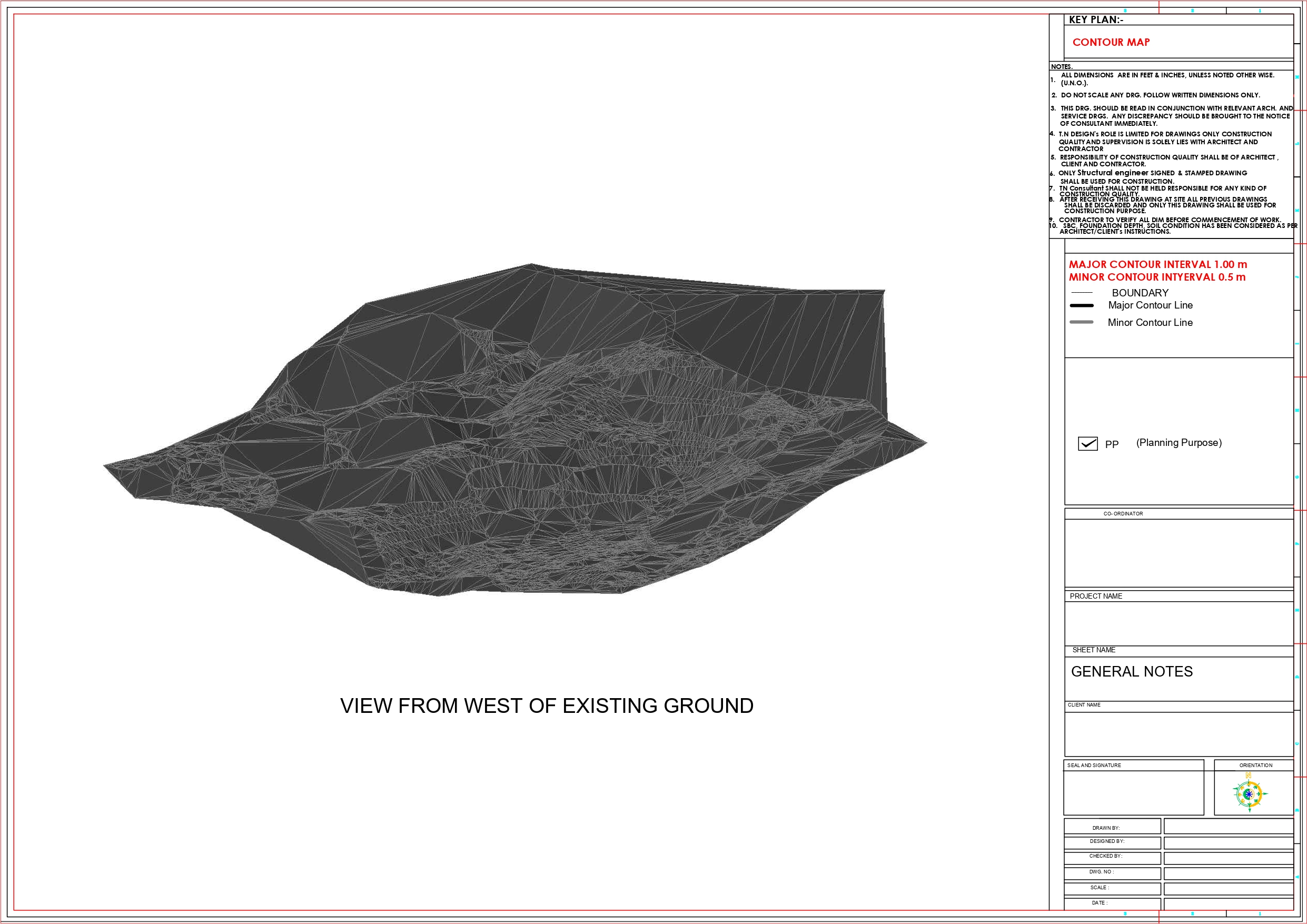
Our topographic surveys provide a detailed representation of natural and man-made features on a piece of land. By accurately capturing contours, elevations, trees, roads, utilities, and other surface details, we deliver precise data essential for architectural design, engineering, and infrastructure planning. This helps architects and developers understand the terrain better, avoid costly errors, and design solutions that fit seamlessly into the landscape.
With a deep understanding of regional geography and infrastructural needs, we specialize in LiDAR-enabled drone mapping, topographic surveys, and innovative infrastructure design. Our team of licensed drone pilots, GIS experts, architects, and civil engineers bring a wealth of technical expertise and field experience to every project.
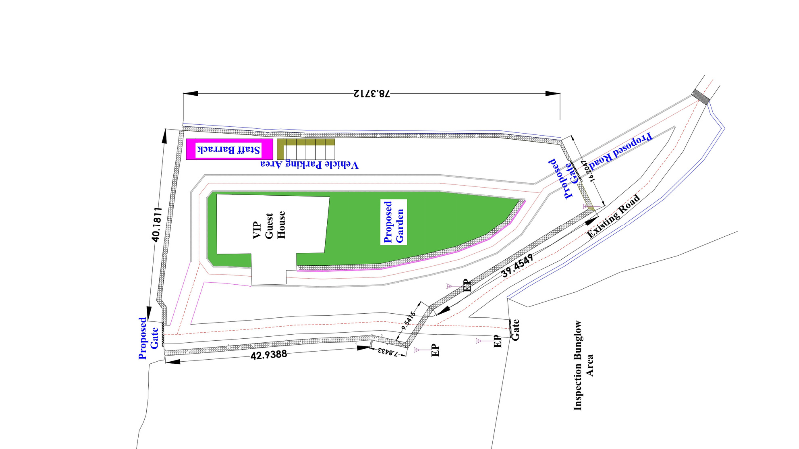
Whether for property ownership, construction projects, or development planning, our land and boundary surveys ensure that every inch of your site is correctly defined. Using advanced surveying tools, we establish legal boundaries, resolve disputes, and provide accurate measurements that are legally defensible. These surveys are critical in securing permits, preventing encroachment issues, and safeguarding your project’s compliance with regulatory requirements.
With a deep understanding of regional geography and infrastructural needs, we specialize in LiDAR-enabled drone mapping, topographic surveys, and innovative infrastructure design. Our team of licensed drone pilots, GIS experts, architects, and civil engineers bring a wealth of technical expertise and field experience to every project.
We harness the power of Geographic Information Systems (GIS) to transform raw data into meaningful, interactive maps. GIS and digital mapping allow for advanced analysis of land use, infrastructure networks, utilities, and environmental factors. From urban development and utility management to rural land planning, our digital maps provide a powerful decision-making tool that improves efficiency, sustainability, and long-term planning outcomes.

we create smart, sustainable, and lasting solutions. Our reputation is built on experience, expertise, and an unwavering commitment to client satisfaction. Here’s why clients across Northeast India trust us:
With decades of field experience, we understand regional challenges and deliver projects that stand the test of time — both structurally and functionally
Our team includes certified drone pilots, engineers, architects, and project managers who bring deep knowledge and a results-driven approach to every assignment.
We utilize cutting-edge tools like LiDAR drones, GIS, and advanced modeling software to ensure data accuracy, efficient planning, and reliable project execution.
From consultation to post-project assistance, our team is always available to guide, inform, and support — ensuring a smooth, stress-free experience for our clients.
Have a project in mind or need expert consultation for surveying, design, or infrastructure development? We’re here to help. Get in touch with our team to discuss your requirements and explore how TN Consultant can bring your vision to life.
Have a project in mind or need expert advice? Reach out — we’re here to help you every step of the way.
Have a project in mind or need expert advice? Reach out — we’re here to help you every step of the way.