From planning to execution, we deliver smart, reliable, and future-ready solutions.
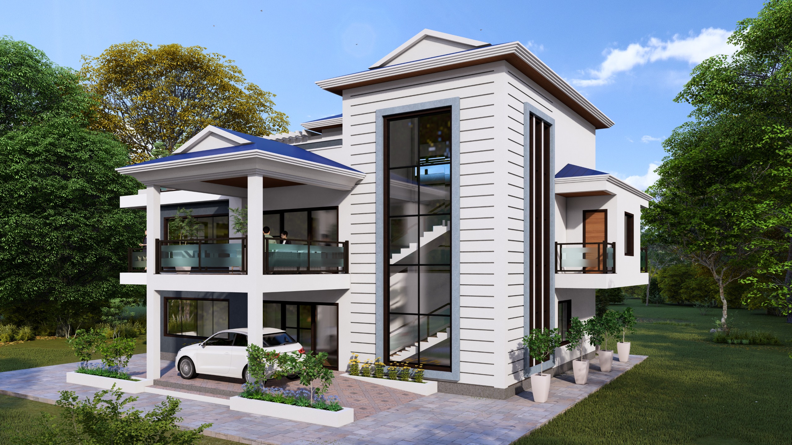
Custom 2D and 3D architectural plans, elevation designs, and interior layouts crafted to blend functionality with aesthetics, tailored for residential, commercial, and institutional projects.
High-precision land surveys using LiDAR-enabled drones, DGPS, and Total Stations for accurate topographic, boundary, and alignment mapping — ideal for infrastructure planning in challenging terrains.
Robust and safe RCC and steel structural designs, backed by in-depth load analysis and code-compliant detailing to ensure stability, durability, and long-term performance.
Advanced LiDAR drone mapping services conducted by licensed pilots and trained surveyors, offering fast and highly accurate data for terrain modeling, volume analysis, and infrastructure alignment.
Detailed GIS-based mapping for land classification, development planning, and environmental assessments — crucial for urban planning and rural infrastructure development.
Complete design services for roadways, drainage systems, and culverts, including horizontal and vertical alignments, pavement design, and DPR preparation for government and private projects.
Have a project in mind or need expert consultation for surveying, design, or infrastructure development? We’re here to help. Get in touch with our team to discuss your requirements and explore how TN Consultant can bring your vision to life.
Have a project in mind or need expert advice? Reach out — we’re here to help you every step of the way.
we create smart, sustainable, and lasting solutions. Our reputation is built on experience, expertise, and an unwavering commitment to client satisfaction. Here’s why clients across Northeast India trust us:
With decades of field experience, we understand regional challenges and deliver projects that stand the test of time — both structurally and functionally
Our team includes certified drone pilots, engineers, architects, and project managers who bring deep knowledge and a results-driven approach to every assignment.
We utilize cutting-edge tools like LiDAR drones, GIS, and advanced modeling software to ensure data accuracy, efficient planning, and reliable project execution.
From consultation to post-project assistance, our team is always available to guide, inform, and support — ensuring a smooth, stress-free experience for our clients.
Have a project in mind or need expert advice? Reach out — we’re here to help you every step of the way.